OpenGeoSys
Open-source multi-physics
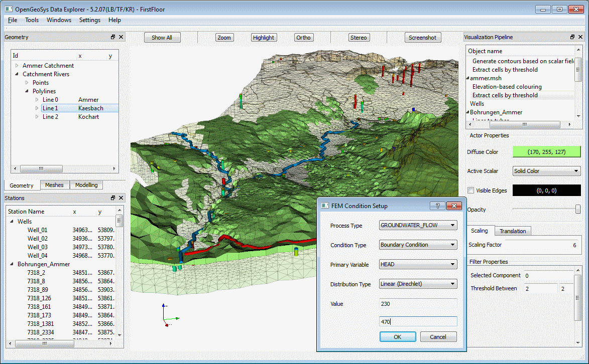
Comprehensive Pre-Processing Tools
A wide range of helper tools exist to get your model up and running with OpenGeoSys.
Convert your existing data sets into appropriate OGS data formats and structures.
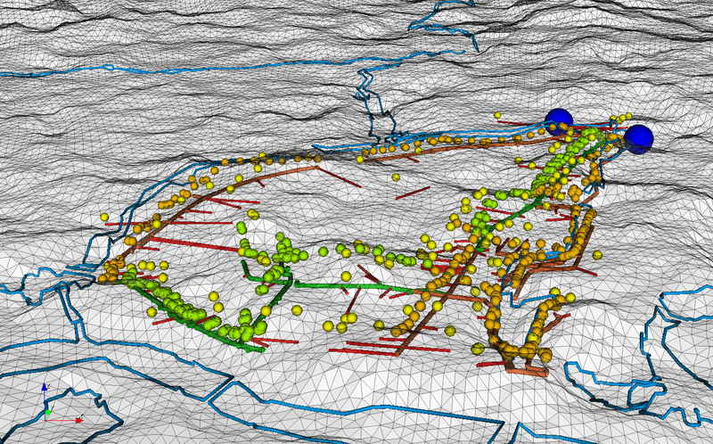
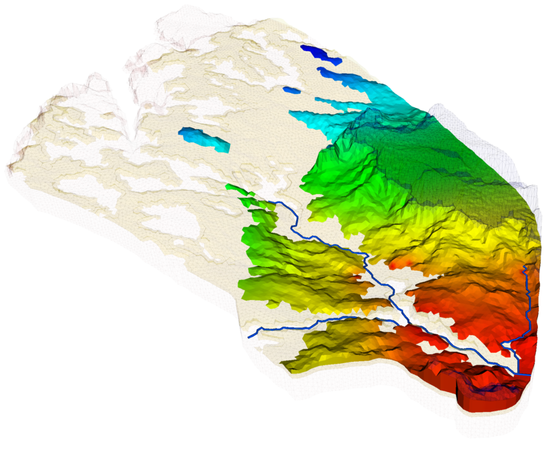
Create meshes approximating geometrically the domain of interest. Analyze mesh quality, cleanup the mesh or adding layers to it.
Parametrize the model with material parameters, boundary conditions and source terms.

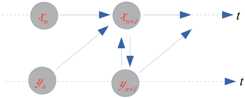
Process Coupling
Data integration
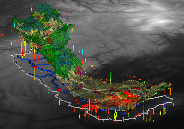
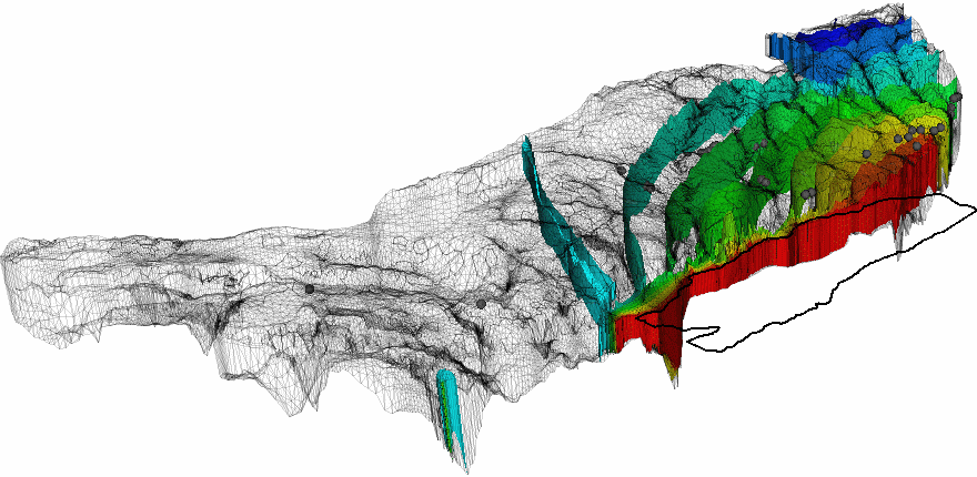
Visualize results
By using VTK data formats visualizing simulation result data sets becomes an easy task. The de-facto standard software for scientific visualtions ParaView can be used to explore and analyze complex data in a visual way.
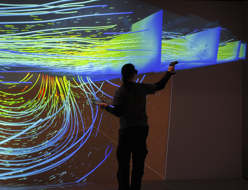
Virtual reality enabled visualization brings your data onto the large screen for intuitive exploration and assessment.
High performance computing
High performance computing (HPC) has became a necessity in the modelling of environmental and geotechnical problems for better characterization of the complexity of geo-systems as well as predicting their evolution in time. Parallel computing is the most efficient method in the high performance computing. In OGS, the parallalization of the finite element (FE) computation is based on the domain decomposition method (DDC).
Decomposed global matricies and vectors are handled by PETSc and the system of linear equations are solved by the performant PETSc solver. PETSc builds upon the Message Passing Interface (MPI) suitable for a wide variety of parallel computing architectures.
Parallelization is implemented for single processes as well problems with coupled processes which are using the same order of element for each process.

Transparent development workflows
Write front-end code with Jekyll or Hugo and push to your Git repo. Forestry will pull in your commits and update the CMS.
Invite your team to create content in a rich UI. Their updates get committed back without merge conflicts.
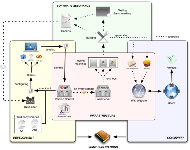
Setup a development environment
Learn how to obtain the source code, how to install required other software (e.g. compilers, code libraries), how to configure the software and how to generate the application binary.
We even provide ready-to-use Docker images to get you started in seconds.
